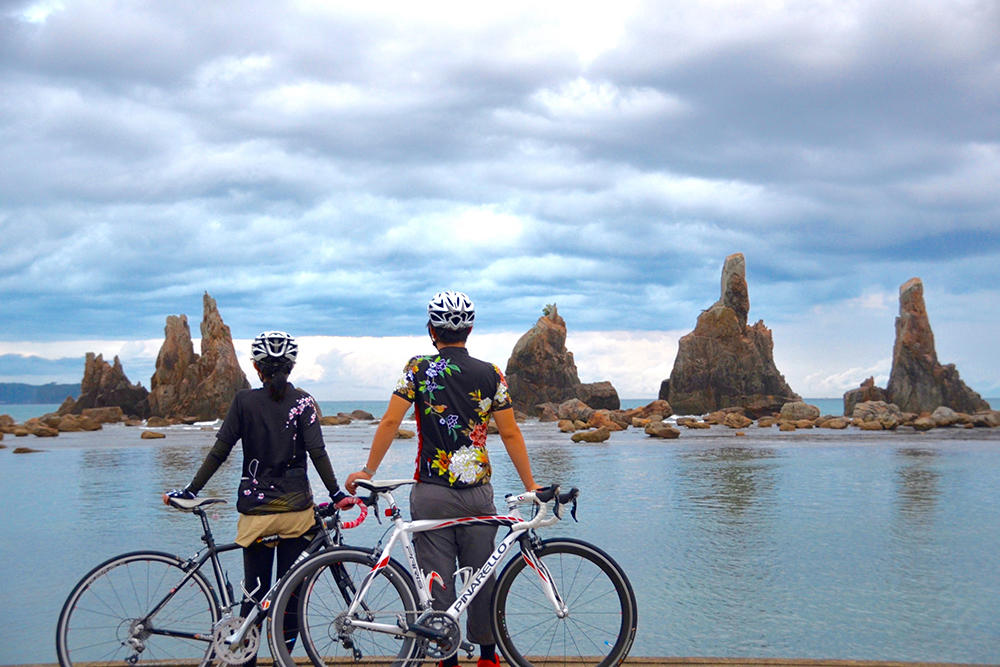
It is a place where you will want to visit at multiple condition such as the rise and fall of the tides, times and cloud movements.
This is a route that goes around the southernmost coastline, looking at some places studded with rocks such as the strangely shaped rock called Kigan or massive rock.
These geographical features and landscapes were chosen to be part of the geological park of “Nanki Kumano Geopark”.
After you leave JR Kushimoto Station (the southern-most railway station on Honshu (the main island of Japan)), you can enjoy cycling along the Pacific Ocean, going around Cape Shionomisaki (located in the Kii Peninsula).
In Wabuka, leave National Route 42 here and head towards the mountainside and cross the small pass that goes towards the Koza River.
Cycle along the tranquil Koza River with looking large and strangely shaped rocks.
On your way, you can go over Chinka Bridge, also known as Sensui Bridge or swing by supernatural and beautiful sights such as “Taki no Hai” (a small river formed from the bedrock) and “Mushi Kui Rock”.
Go back to National Route 42 along the beach around the Koza River estuary and then head to the seaside attraction that you can see on your left side.
Along this coastline, you can enjoy seeing unique geographical landscapes such as Taijima Island and Hashikui-iwa Rock. Afterwards, you can go back to JR Kushimoto Station, which is the final end goal.
Distance: 94km, Elevation Gain: 1,808m
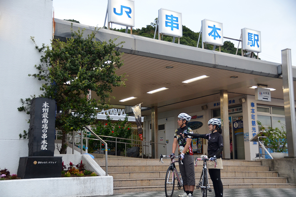
The start and end goal of this route is JR Kushimoto Station (the southern-most railway station on Honshu). There is a stone monument which mentions this information.
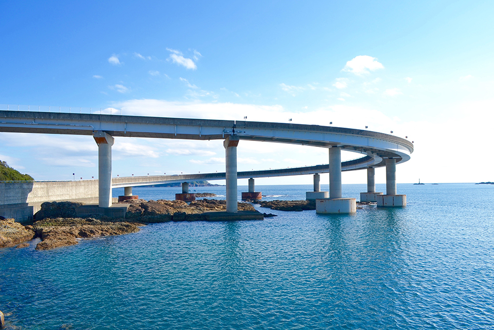
On the way to Cape Shionomisaki, you can cycle on the loop bridge (known as “Kushimoto Bridge”), which goes from Kushimoto to Kii Oshima. When you go down from the loop bridge, which sticks out into the sea, you can experience the thrill and exhilarating feeling of almost diving into the Pacific Ocean.
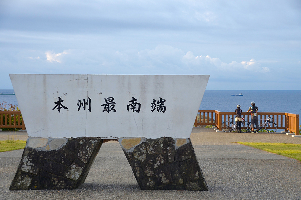
At the public square of Cape Shionomisaki where you can look over the boundless expanse of the Pacific Ocean, the stone monument standing there mentions that here is the “southern-most point on Honshu” and is an excellent place for taking pictures.
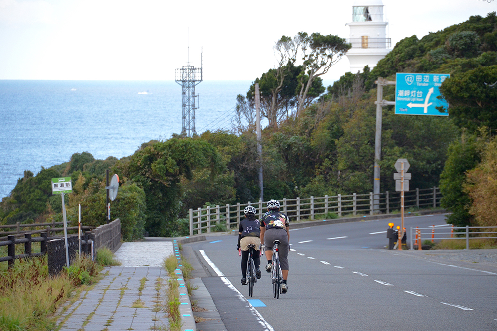
After you leave Cape Shionomisaki, you will cycle towards the coastline with the view of the Pacific Ocean on your left.
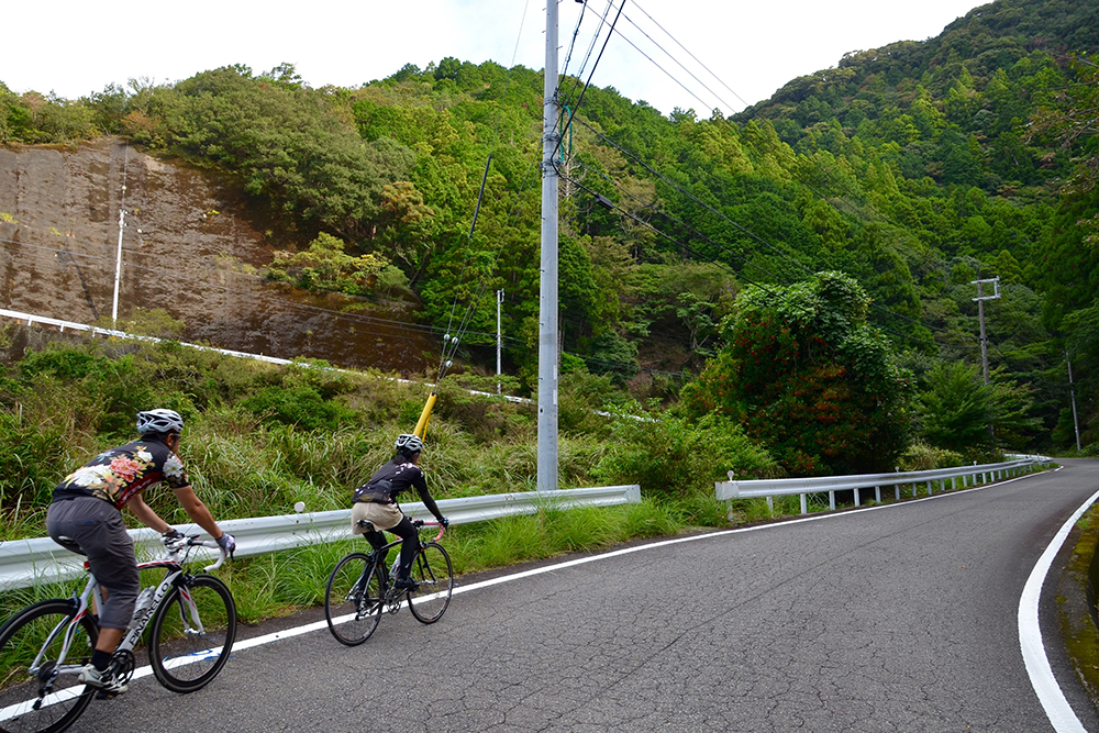
In Wabuka, leave National Route 42 here and head towards the mountainside and cross the small pass that goes towards the Koza River.
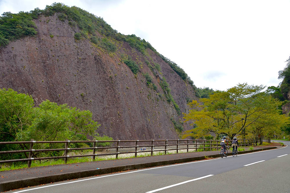
When you go back to Route 371 from an enticing side road avoiding the tunnels, there is a single massive rock known as “Kozagawa no Ichimai Rock”, towering about 150m above and about 800m wide which will appear in front of you. It is one of the largest single rocks in Japan, so it is hard to see all of it.
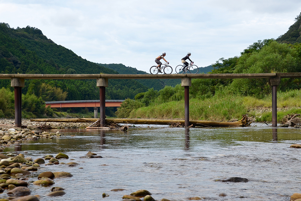
When you go straight down the narrow road on your right side, which is located in front of Myojin Post Office along the Koza River, there will be the elegant “Myojin Sensui Bridge”. Under high flow conditions, water runs over the bridge and it will disappear under the water, that is why it is called a “Chinka Bridge” (Sinking Crossing Bridge). If you cross this farm road by bike, you may feel as if you come closer to a more natural and countryside life.
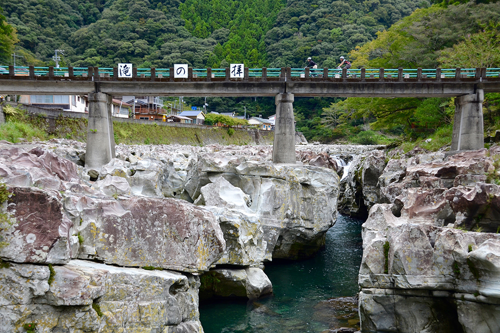
Once you leave the Koza River and go back towards the river tributary for about 12km, “Taki no Hai” will appear where the clear water is streaming among an endless number of big and small uniquely shaped rocks. From the bridge, you can see a lot of pot holes that have deep holes.
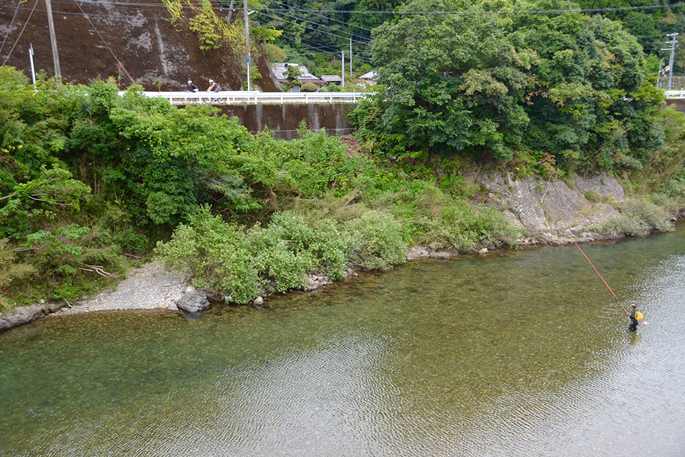
Koza river has extremely clear water and it is a famous place for ayu (sweetfish) fishing for ages. When you ride a bicycle along the riverside, you will be able to see many anglers who have fishing rods, with their lines in the river.
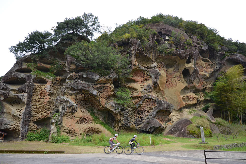
When you return to the main course of the Koza River, visit one more place, “Mushi Kui Rock” (Worm-Eaten Rock).The rock was eroded by the wind and rain and as the name indicates, there are many small holes. You can see this huge rock close-up and you will be overwhelmed, because the rock is over 60m in height.
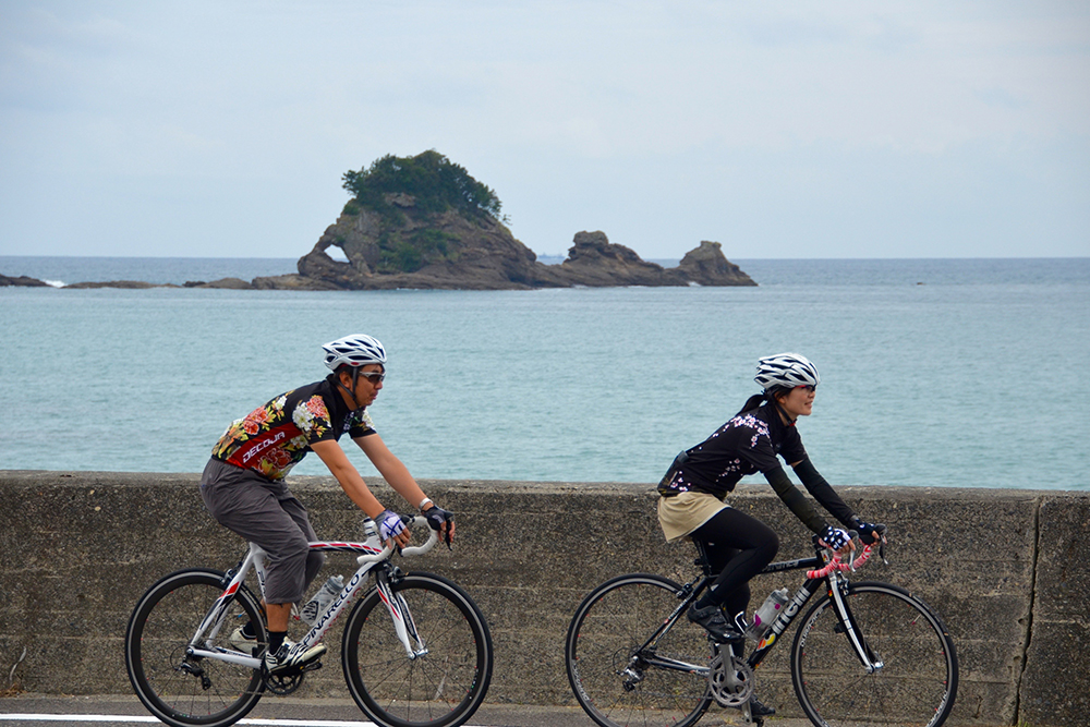
Go back to the beach from the Koza River estuary and then ride your bike along the coastline next to the shiny blue Kumano Sea. You can see “Taijima Island” with the shape of sea bream on your left-hand side, which is located off the coastline along with Kuroshima island.
Kushimoto’s delicious “himono” (dried fish) is good for lunch or as a souvenir.